

The majority of the new route will be fully segregated from both traffic and pedestrians. A short section will be shared with pedestrians.
Some trees may be removed (between the Ring Road and Newbury Road and between Johnstone Street and Hatfield Road) to allow for the new route. These will be replaced in the local area.
The information below is intended to give information about how the route may look. At this stage, the information is indicative and will be subject to consultation and detailed design work.
Proposed new route map
1. Dale End/James Watt Queensway: two-way cycle track segregated from pedestrians and traffic.
2. Connection to existing cycle paths through Lancaster Circus subway.
3. Lancaster Street: cyclists cross using existing Toucan crossing.
Section A: Two-way cycle-track, segregated from pedestrians and traffic on the west side of New Town Row.
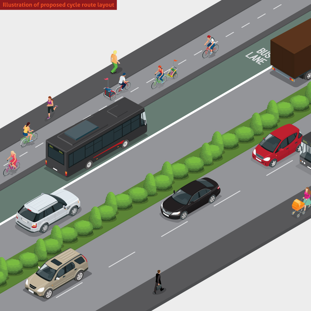
(Illustration of cycle route layout below)
4. New Town Row/Middleway: minor junction alterations to provide a dedicated two-way cycle track across
the junction.
Section B: Two-way segregated cycle track created from the existing verge area. (Illustration of cycle route layout below)
5. Milton Street: new Cycle Zebra Crossing and narrowing of side street.
6. Barton Arms junction: minor junction alterations to provide a dedicated two-way cycle track across the junction.
7. Rodway Close. (Artist’s impression below)
8. Lozells Road: alteration to existing traffic signal crossing to provide an adjacent cycle track crossing.
9. Lozells Road (Artist’s impression to be published soon)
10. Heathfield Road: minor junction amendment to provide a cycle crossing over Heathfield Road.
11. Route continues to Perry Barr Green Travel District. A number of options are being considered for the type
of track.
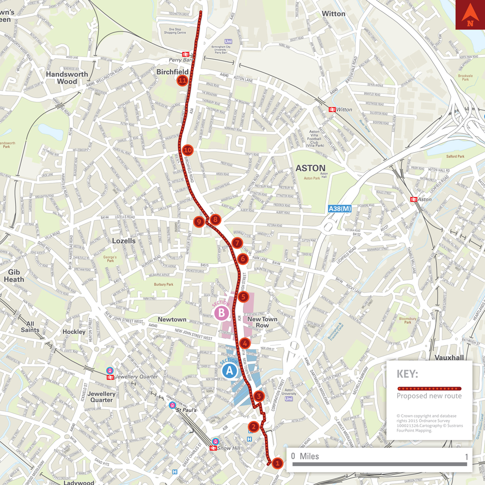
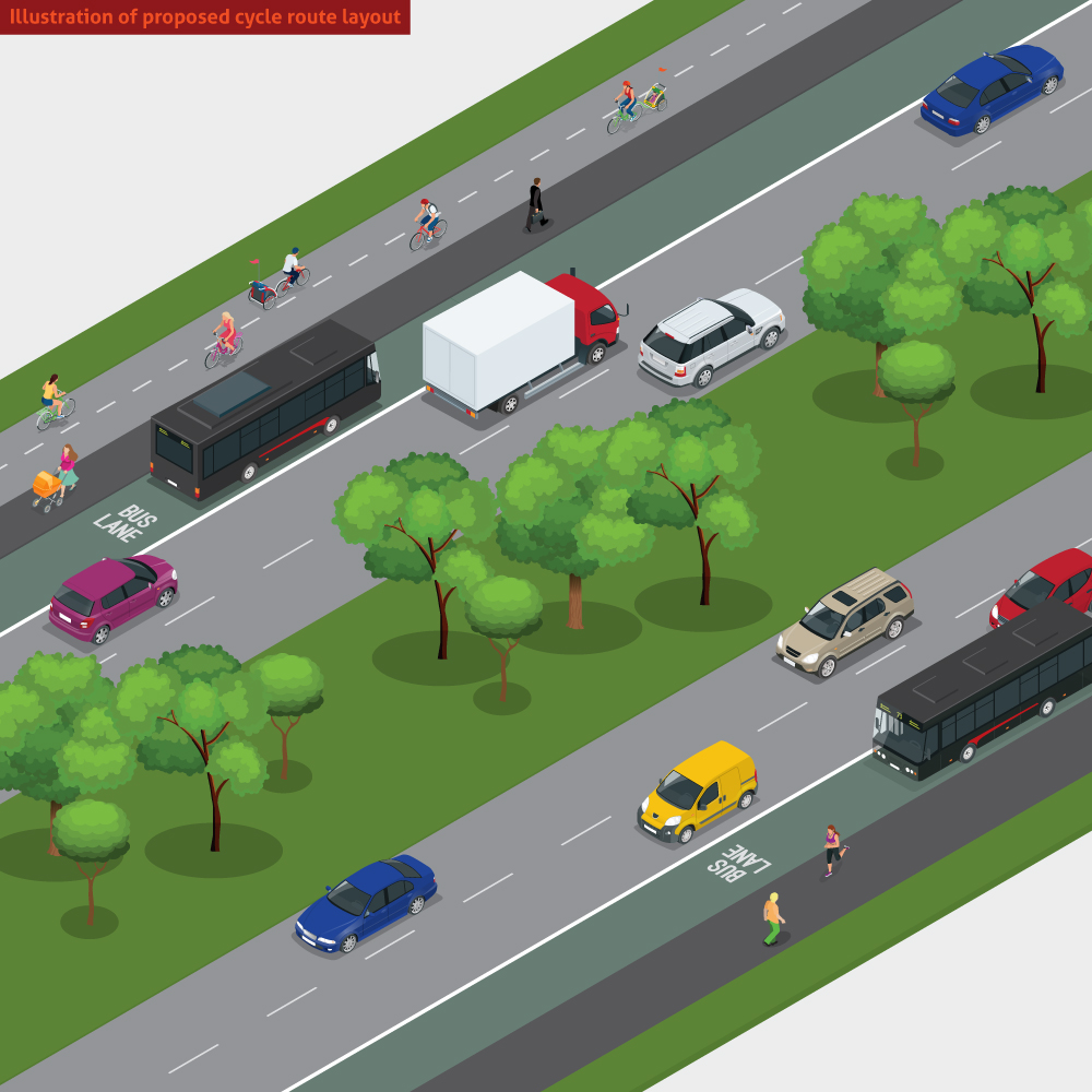
Illustration of proposed new cycle route layout
This visual shows the road and new cycle route layout within section A on the map:
Artist's impression
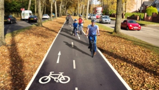
This shows how the proposed new cycle route will look at Rodway Close (location 9 on the map):
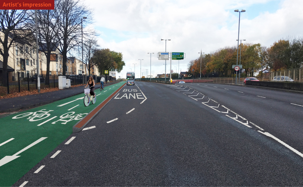
Illustration of proposed new cycle route layout
This visual shows the road and new cycle route layout within section B on the map: