


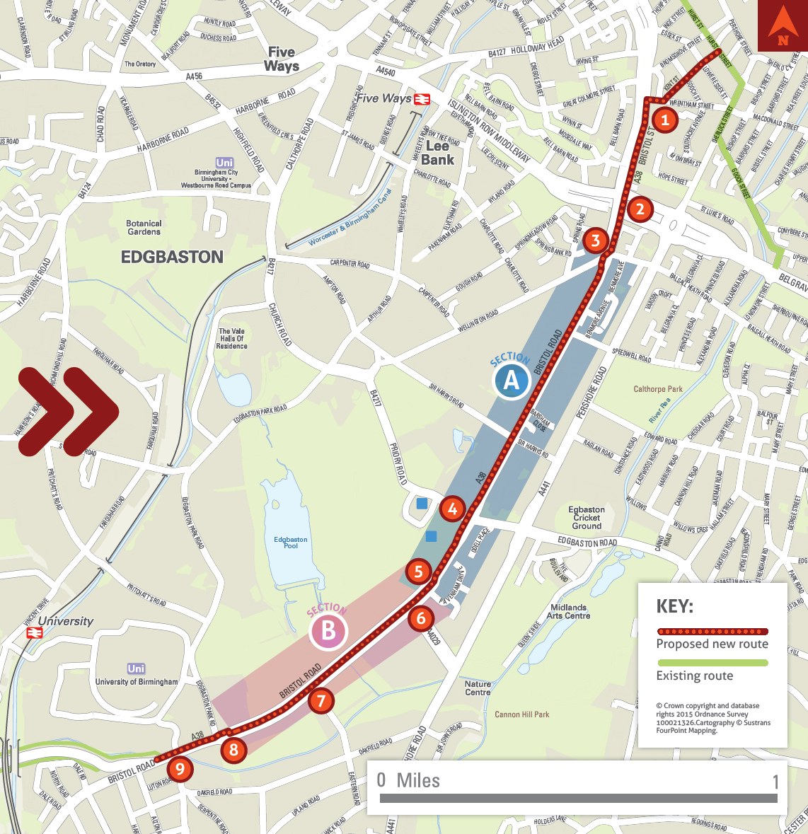
The route will connect with the existing cycle facilities on Hurst Street, running along Kent Street, Wrentham Street and onto Bristol Street.
From Bristol Road, the route will run alongside the pedestrian footway, before crossing into the wide central reservation where a dedicated track will run to Edgbaston Park Road. A further section next to the footway then links the route to existing cycle facilities on Selly Oak New Road.
Improvements to the junctions at Belgrave Middleway and Priory Road will benefit pedestrians as well as cyclists.
Up to 20 trees may be removed. These will be replaced in the local area.
The information below is intended to give information about how the route may look. More detailed design drawings are included on the consultation webpage.
Proposed new route map
1. Cycle track from Hurst Street to Belgrave Interchange, segregated from traffic and pedestrians.
2. Belgrave Interchange: dedicated cycle track through junction between Bristol Road and Bristol Street, improvements for pedestrians, a safer design for right turning traffic from the A38 onto the Middleway. (Artist’s impression below)
3. Wellington Road: alterations to existing signal crossing, creating separate facilities for cyclists and pedestrians.
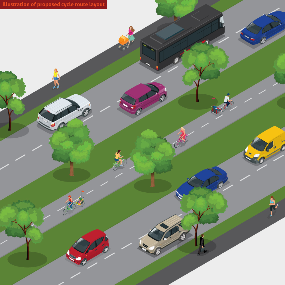
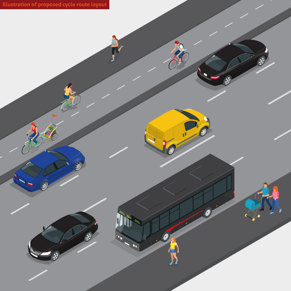
Section A: Cycle track on the west side of Bristol Road, using some of the current footway space. Cyclists will be at different height to both traffic and pedestrians. (Illustration of cycle route layout below)
4. Priory crossroads: addition of three pedestrian crossings and a continuous cycling track across Priory Road. Some turning movements will be banned, improving safety and efficiency of the junction.
5. New signal controlled crossing to bring cyclists from the west side of the road to the central reservation.
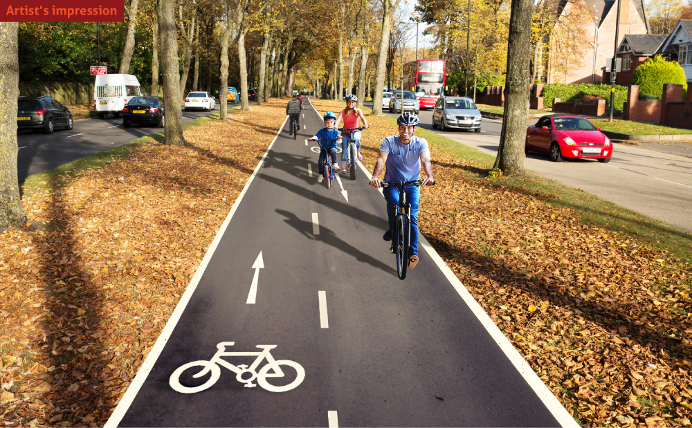
Section B: Cycle track running within the tree lined central reservation, segregated from pedestrians and traffic. (Illustration of cycle route layout below)
6. Pebble Mill Road: signalisation of the right turn from Bristol Road into Pebble Mill Road. Right turn from Pebble Mill Road banned.
7. Eastern Road: two part cycle crossing of the gap in the central reservation.
8. Edgbaston Park Road: minor junction alterations including a signal controlled crossing to bring cyclists from the central reservation to the west side of Bristol Road. Pedestrian facilities improved.
9. Bournbrook Road/University South Gate: slight change to junction layout to accommodate cycle route. Route links with cycle facilities on Selly Oak New Road and the Selly Oak Green Travel District.
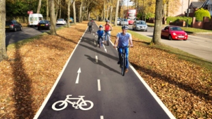
Artist's impression
This shows how the proposed new cycle route will look on the Belgrave Interchange on the A38 (location 2 on the map):
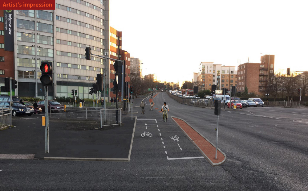
Illustration of proposed cycle route layout
This visual shows the new cycle route layout on the West side of the Bristol Road (section A on the map):
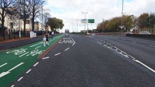
Artist's impression
This shows how the proposed new cycle route will look on the central reservation (section B on the map):
h2 class="content">Illustration of proposed cycle route layout
This visual shows the new cycle route layout on the central reservation along the Bristol Road (section B on the map):